Location: Los Angeles County
Project Type: Restoration
Status: Current
Cost: $12,360,000
Funding Gap: $9,400,000
Area Affected: 80 acres
Project Footprint: 72 stream miles
Assembly District: 38, 39, 43, 45, 46, 51
Senate District: 18, 21, 24, 25, 27
Congressional District: 25, 28, 29, 30, 33, 34
Project Lead/Grantee:
Council for Watershed Health
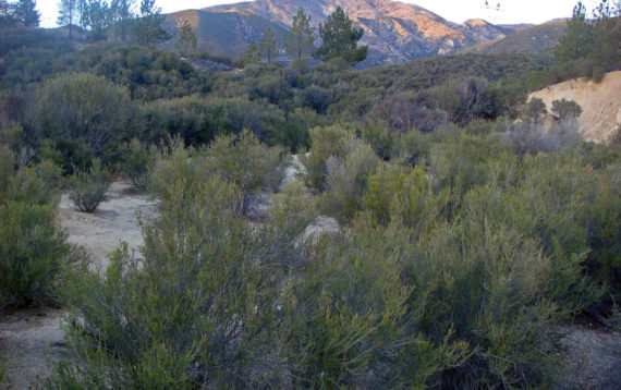
In partnership with parallel efforts occurring in the Tujunga Wash, the Upper Los Angeles River Watershed Arundo Eradication Program’s objective is the eradication of approximately 80 acres of Arundo donax, a highly invasive riparian plant species, for the remaining areas of the Upper Los Angeles River Watershed. The project will impact an estimated 72 miles of stream. Arundo (commonly referred to as giant reed) has significant negative impacts on water availability, water quality (i.e. sediment loads, temperature, pathogens, nutrient loading, flow modification), habitat, fires, and infrastructure. Arundo transpires water at a rate that is 5x higher than native vegetation.
The Program’s area of interest focuses on those Arundo populations that negatively impact City of Los Angeles’ water resources, both in the City jurisdiction and upstream in the surrounding San Gabriel, Santa Susana, and Santa Monica Mountains. Targeting these remaining Arundo populations strategically eliminates opportunities for its expansion downstream and will result in a net water savings of 1600 acre-feet of water per year (AFY). Because Arundo spreads only by the dispersal of fragments downstream (no viable seed is produced), this program facilitates projects that eradicate Arundo through use of a top-down treatment approach. The exact treatment approach, foliar spraying or cut and dab, and the process for biomass removal varies by landowner and is performed in consultation with the permitting agencies and the environmental analysis to mitigate any potential impacts.
The Upper Los Angeles River (ULAR) Watershed represents the project’s geographic boundary, from the headwaters in the mountains surrounding the San Fernando Valley downstream to the Los Angeles River/Arroyo Seco confluence (just north of downtown). This project now includes the Upper Tujunga Wash portion of the ULAR watershed where the National Forest Foundation has been previously treating Arundo (Year Six) on a parallel eradication program (100+ acres). For the larger ULAR watershed project, there is an additional 80 acres outside of the Tujunga program that is being targeted. Coordinating partners include the following agencies and landowners: City of Los Angeles, Angeles National Forest, US Army Corps of Engineers, Los Angeles County Agricultural Commissioner’s Office, Los Angeles County Flood Control District, California State Parks, Southern California Edison, National Parks Service/Santa Monica Mountains Recreation Area, and the Cities of Burbank, Glendale, Hidden Hills, and Calabasas.