Location: Santa Barbara County
Project Type: Restoration
Status: Completed
Habitat Type: Erosion/Sedimentation, Freshwater Wetland, Public Access/Recreation, Riparian, Tidal Wetland
Cost: $14.5 million
Funding Gap: $14.5 million
Area Affected: 2,800 acres
Project Footprint: 7.2 stream miles
Assembly District: 37
Senate District: 19
Congressional District: 24
Project Lead/Grantee:
California State Parks: Nat Cox, 805-648-8194
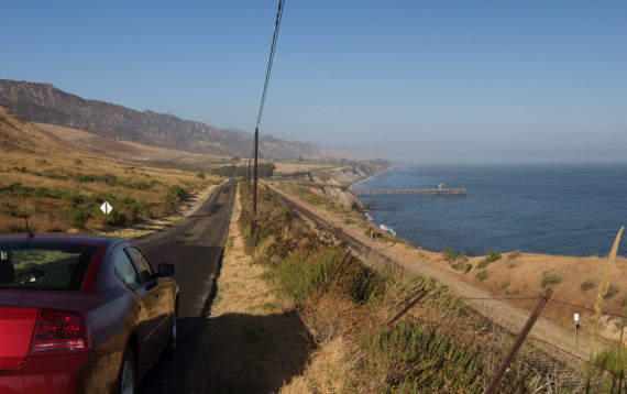
This project aims to relocate Gaviota Beach Road (entry road) to create an all-weather access road and stream crossing for Gaviota State Park and neighboring Hollister Ranch. Relocating the road will benefit recreational use by improving access to Gaviota State Park. The project will also benefit sandy beaches by relocating the road out of the lower floodplain, restoring a more natural flow to Gaviota Creek and allowing for the undisrupted transportation of sediment to replenish sandy beaches down coast. Gaviota Creek is also known to host several rare, threatened and endangered species, including tidewater goby, southern steelhead trout, and California red-legged frogs all of which may potentially benefit from the road realignment and associated restoration of the lower floodplain.
The current alignment of the Gaviota entry road has impacted Gaviota Creek by restricting it from reaching much of its historic lower floodplain and altering transportation and deposition of sediment. The creek is currently locked into its northernmost alignment because of the entry road and is not able to meander naturally across the lower floodplain. During major storm events and periods of high flow, the creek overflows onto the entry road and deposits large amounts of sediment onto the road. This often results in extended park closures for Gaviota S.P. as well as impacts to the Hollister Ranch residents who use Gaviota Beach Road as their primary access route. This road also is the primary access to critical oil and gas infrastructure within Gaviota S. P. and road closure could deny access to several pipelines for the purpose of routine maintenance or emergency response. In order to restore and maintain access, the sediment deposited on the road during these flood events was historically pushed to the side and over time resulted in unnaturally high berms (6-10ft) along the entry road. These berms are infested with exotic vegetation and their presence continues to alter creek flow and disrupt natural sediment transport and deposition in the lower floodplain and the nearshore environments.
The proposed project is to realign the entry road so that it bypasses much of the lower floodplain and ties into the existing “Road 28” service road. Also proposed with the road realignment is a new point of entry/exit upstream of the current entry point with an appropriately designed bridge crossing over the creek. Once the new alignment is complete, the existing entry road will be decommissioned and unnatural berms will be removed to facilitate restoration of the lower floodplain of Gaviota Creek. This project will result in Gaviota Creek being allowed to meander more freely over the lower floodplain, provide better quality habitat for rare, threatened and endangered species, and carry sediment out to the ocean to replenish down coast sandy beaches.